VNPT Global Solutions
VGSBuild to operate. Trusted to deliver.
🌐 𝐁𝐞𝐲𝐨𝐧𝐝 𝐃𝐫𝐨𝐧𝐞𝐬: 𝐇𝐨𝐰 𝐀𝐈 𝐚𝐧𝐝 𝐔𝐀𝐕𝐬 𝐂𝐫𝐞𝐚𝐭𝐞 𝐍𝐞𝐰 𝐏𝐨𝐬𝐬𝐢𝐛𝐢𝐥𝐢𝐭𝐢𝐞𝐬
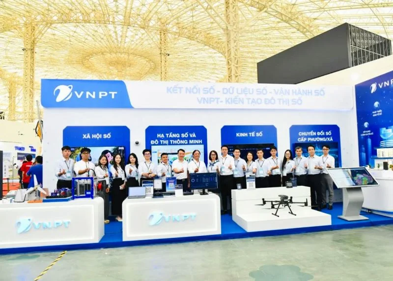
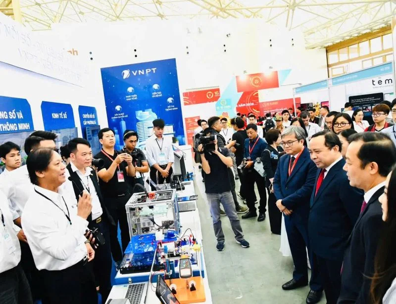
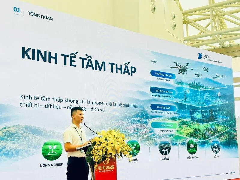
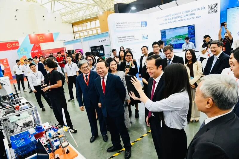
🌐 𝐁𝐞𝐲𝐨𝐧𝐝 𝐃𝐫𝐨𝐧𝐞𝐬: 𝐇𝐨𝐰 𝐀𝐈 𝐚𝐧𝐝 𝐔𝐀𝐕𝐬 𝐂𝐫𝐞𝐚𝐭𝐞 𝐍𝐞𝐰 𝐏𝐨𝐬𝐬𝐢𝐛𝐢𝐥𝐢𝐭𝐢𝐞𝐬 At the National Digital Transformation High-Level Forum and Smart City Asia 2026 in Hanoi, VNPT showcased a broad portfolio of digital solutions spanning AI, unmanned aerial vehicles (UAVs), healthcare, smart agriculture, and digital infrastructure. One area of focus is the emerging 𝐥𝐨𝐰-𝐚𝐥𝐭𝐢𝐭𝐮𝐝𝐞 𝐞𝐜𝐨𝐧𝐨𝐦𝐲, where VNPT is moving beyond individual drone devices toward a comprehensive ecosystem of equipment, data, platforms, and services. 𝐀 𝐤𝐞𝐲 𝐩𝐫𝐢𝐧𝐜𝐢𝐩𝐥𝐞 𝐢𝐬 𝐭𝐡𝐞 𝐬𝐡𝐚𝐫𝐞𝐝-𝐩𝐥𝐚𝐭𝐟𝐨𝐫𝐦 𝐚𝐩𝐩𝐫𝐨𝐚𝐜𝐡. Rather than requiring each industry to invest in separate devices and systems, VNPT UAV Platform enables multiple applications to operate on a common platform. A single flight mission can collect multiple layers of data to support different operational needs, helping reduce duplicated investments while building a flexible data foundation for future applications. This approach opens up practical applications across sectors: 🌳𝐄𝐧𝐯𝐢𝐫𝐨𝐧𝐦𝐞𝐧𝐭𝐚𝐥 𝐌𝐨𝐧𝐢𝐭𝐨𝐫𝐢𝐧𝐠: UAV-collected data can support forest monitoring and the identification of potential fire risks. 🏗️𝐈𝐧𝐟𝐫𝐚𝐬𝐭𝐫𝐮𝐜𝐭𝐮𝐫𝐞 𝐈𝐧𝐬𝐩𝐞𝐜𝐭𝐢𝐨𝐧: Aerial data can help inspect roads, telecommunications infrastructure, and other assets, reducing the need for certain manual inspections at height. 🗺️𝐋𝐚𝐧𝐝 𝐌𝐚𝐧𝐚𝐠𝐞𝐦𝐞𝐧𝐭: Integrated with digital mapping and GIS capabilities, UAV data can support land-use monitoring and the detection of changes on the ground. 🌾𝐒𝐦𝐚𝐫𝐭 𝐀𝐠𝐫𝐢𝐜𝐮𝐥𝐭𝐮𝐫𝐞: Combined with solutions such as VNPT Green, UAV technologies can contribute to crop monitoring and more informed agricultural management. Beyond UAVs, VNPT also showcased solutions in AI-powered healthcare, Edge AI devices, and digital governance, demonstrating how AI, IoT, and data technologies can improve operational efficiency and make better-informed decisions across industries. Together, these examples illustrate how VNPT connects technologies within an integrated ecosystem, where shared platforms and reusable data can support multiple applications rather than isolated use cases. 👉𝐈𝐧𝐭𝐞𝐫𝐞𝐬𝐭𝐞𝐝 𝐢𝐧 𝐛𝐫𝐢𝐧𝐠𝐢𝐧𝐠 𝐭𝐡𝐞𝐬𝐞 𝐝𝐢𝐠𝐢𝐭𝐚𝐥 𝐢𝐧𝐧𝐨𝐯𝐚𝐭𝐢𝐨𝐧𝐬 𝐭𝐨 𝐲𝐨𝐮𝐫 𝐦𝐚𝐫𝐤𝐞𝐭? 𝐂𝐨𝐧𝐧𝐞𝐜𝐭 𝐰𝐢𝐭𝐡 𝐕𝐆𝐒 𝐭𝐨 𝐬𝐭𝐚𝐫𝐭 𝐚 𝐜𝐨𝐧𝐯𝐞𝐫𝐬𝐚𝐭𝐢𝐨𝐧. 𝐕𝐍𝐏𝐓 𝐆𝐥𝐨𝐛𝐚𝐥 𝐒𝐨𝐥𝐮𝐭𝐢𝐨𝐧𝐬 Build to operate. Trusted to deliver. 𝐖𝐞𝐛𝐬𝐢𝐭𝐞: https://global.vnpt.vn 𝐄𝐦𝐚𝐢𝐥: vgs@vnpt.vn 𝐃𝐞𝐩𝐮𝐭𝐲 𝐃𝐢𝐫𝐞𝐜𝐭𝐨𝐫: Duc Pham (David) 𝐇𝐞𝐚𝐝 𝐨𝐟 𝐁𝐮𝐬𝐢𝐧𝐞𝐬𝐬 𝐃𝐞𝐯𝐞𝐥𝐨𝐩𝐦𝐞𝐧𝐭: Amelia Trang Doan #VNPTGlobalSolutions #VNPT #DigitalTransformation #AI #UAV #LowAltitudeEconomy #DigitalInnovation #Drone … more
#VNPTGlobalSolutions#VNPT#DigitalTransformation#AI#UAV#LowAltitudeEconomy#DigitalInnovation#Drone